At the beginning of the 1880s, Acatenango Volcano was partially unexplored. In 1881, the writer Eugenio Dussaussay, together with Tadeo Trabianno, attempted to climb Acatenango’s central peak. However, after requesting permission from the Political Chief of Sacatepéquez, who referred them with a letter to the mayor of Alotenango requesting that he provide the explorers with the necessary safety measures to climb Acatenango, they could not find a guide to reach the central peak and decided to reach the active cone, which according to records erupted in the year 1880.
The mayor was only able to find 3 people to accompany the two explorers. The only volunteer willing to accompany Dussaussay and Trabanino was Rudecindo Zul, while 2 laborers were forced by the mayor. They reached an agreement that the explorers should bring aguardiente so the men would accompany them.
The five people began the journey carrying the aguardiente, navigation instruments, and weapons to defend themselves from the jaguars that inhabited the area at that time. The ascent began in Alotenango with a walk of approximately 16 kilometers across a plain until reaching the first resting point known as “del Castillo” or “Gajoteachucuyo”, located in the lower areas of the volcano.
The terrain was surrounded by extensive vegetation with some oak trees, evergreen oaks with acorns, avocado trees, and amate trees. As they advanced, the vegetation became denser, so Zul and the laborers had to cut some plants with machetes to clear the way.
During one part of the trail, they came across large curtains of steam floating in the air and pushed by the wind in all directions. Some were denser and rested over the mountain. Upon reaching the place known as “El Cipresal”, named because there are 6 cypress trees in the area, they were covered by a thick fog. Dussaussay then proceeded to measure the temperature, and the thermometer read 2 degrees above 0. The dense fog turned into rain over the area.
After leaving the area of “El Cipresal,” the vegetation changed drastically, with wild chestnut trees that grow in highlands becoming predominant. The explorers, together with Zul and the laborers, spent the night there and improvised a hut with branches and leaves. At dawn, from where they were, they could see the department of Escuintla and part of the Pacific Ocean, Agua Volcano, the city of Antigua and New Guatemala, and in front of them was the peak of Fuego Volcano.
After resting for a while, they gathered their belongings and continued along the trail until reaching a place known at that time as the “first plateau”, where Zul and one laborer went no farther because of the fear the Indigenous people of the area had of Acatenango Volcano. Only one laborer accompanied the explorers to the second plateau, which leads toward the volcano’s crater.
Upon reaching the second plateau, the vegetation had decreased, and only a few old pine trees remained; farther ahead, the vegetation would disappear completely. Only the explorers reached the summit by way of a narrow trail where the wind blew strongly. They were amazed by the view toward the horizon. After an ascent of around 16 hours, the descent took a total of 4 hours.
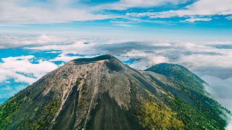
According to eruption records, it is believed that the volcano collapsed approximately 43 thousand years ago and formed an avalanche of volcanic rocks that covered an extensive area of the Pacific region. It is also believed that the summit known as Yepocapa finished forming 20 thousand years ago, and later the highest peak, or Pico Mayor, was formed.
The area of what is now the Astillero Municipal Volcán de Acatenango Municipal Regional Park, together with some surrounding areas, belonged to a private individual named Agustín Aceituno, but he had to give up the land due to an embargo carried out by the Agricultural Development Bank (BANDESA). The land was handed over to some people from the community of Nejapa for agricultural use.
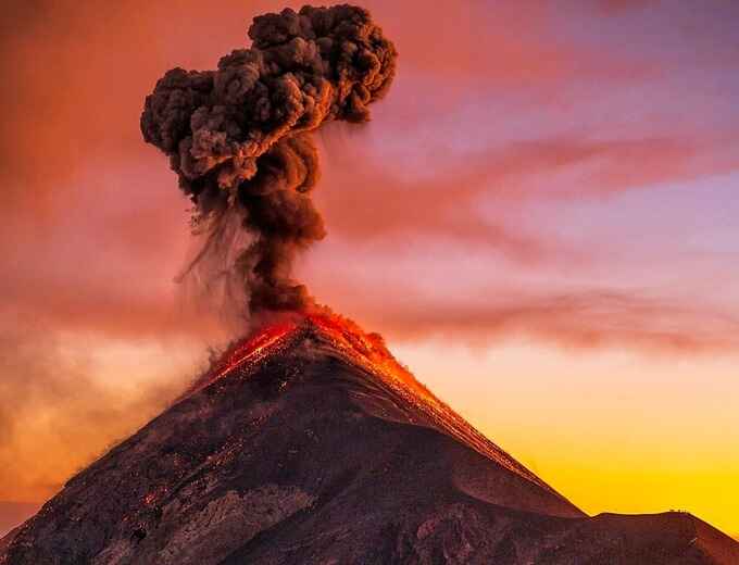
Some recorded eruptions include one in 1661, with only smoke, followed by some ash and gas eruptions between 1924 and 1927.
The last recorded eruption of Acatenango Volcano was in December 1972, when the colossus ejected volcanic bombs, meaning lava that cools in the air and falls in the shape of small asteroids. It is estimated that this eruption covered a radius of 25 kilometers in the region with ash.