To ascend the Acatenango Volcano there are different routes, which will give you different experiences each one, in addition, you must bear in mind that the routes Concepción and the Cypresses do not lead to the summit Yepocapa.
It starts in the village of the same name, but it is not a route where the ascent is faster nor where less equipment is used, on this path the start is difficult due to the slope and the ground is sandy and slippery.
To get to the official entrance of the volcano, you can choose two trails, the first one starts on a paved and very steep road that starts in front of the village parking lot, after the first climb it turns into a dirt road and on the way it becomes a narrow road, you will have to pass some corn and vegetable fields, then you cut to the left and the road levels out again.
Both trails meet at the first point of passage, where you can take the opportunity to eat or use the toilet. You continue along the path through sembradíos until you reach the forest and the official entrance, where you must pay your entrance fee and fill out a registration form, which serves for statistical data from the National Council of Protected Areas of Guatemala (CONAP).
This route is considered as the easiest route, it surrounds the south and east sides of Acatenango. It contains some steep sections, however, the road is wide and level. On this road you will find the access road for double-wheel drive vehicles until you reach the place called El Tonel.
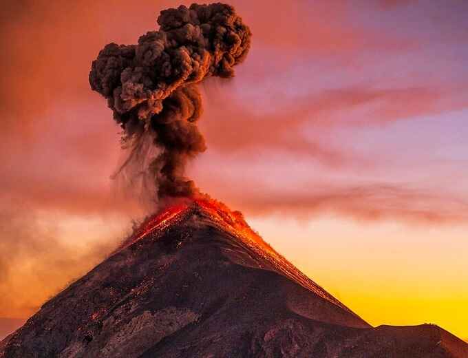
From that reference point, the trail continues with a small slopes until it reaches the area of Alotenango camp (camping here has an additional cost since it is managed by the municipality of Alotenango). This place offers a view of the volcanos of Agua (Hunahpú) and Pacaya, in addition to the majestic Fuego Volcano.
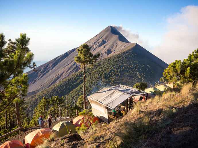
On this route you can find the plateau El Conejo where you can enjoy the experience bivouac (activity of sleeping outdoors), and if you take your tent you can sleep on the plate of the central cusp.
This route contains some variants, after arriving at El Conejo, you can skirt on the right side which is the official or more tourist route, and you can also do on the left side where you can find a route that leads to the Fuego Volcano.
From El Conejo you can head to this point or to the Alotenango camping area, this is a more extensive and steep route. You can also get to the junction of the Acatenango peaks, taking an alternative trail from El Tonel.
This route contains a stretch of volcanic sand, so it becomes a bit difficult and should be taken into consideration.
This route leads along the western side of the volcano, contains about 12 zigzags and is located west of the junction of the two peaks of Acatenango. In addition, this route is wide and has several rest stations, camping places and latrines.
It is considered the ideal route for people who do not have good physical condition or for beginners.
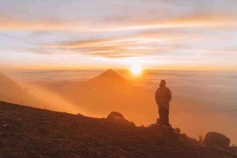
This route is very steep until you reach the summit Yepocapa, which is the smallest peak of the volcano and is located before reaching the union of the peaks and then you can climb to the pico mayor.
When you reach the junction of the two peaks, you will be a few moments away from making the last ascent to the Major Peak, you can choose to climb the west side, better known as La Maldita, or, you can ascend the east side, better known as La Bendita.
This trail is entirely of volcanic sand and the ascent is complicated due to the instability of the soil. The help of a cane in this section is indispensable to avoid slipping.
This route is the most frequented, however, it is well defined and with a moderate slope. On this route you can find a large plateau where it is appropriate for camping and is surrounded by trees. It is two hours from the starting point and from there it takes two hours to reach the summit at a regular pace.
The same route of solitude is covered, however, before the first break you must take the detour to the left until you find the road or route called Concepción. When you finish the road, there is about an hour and a half left to reach the main summit.
It is usually ascended together with the Fuego Volcano. This route is also known as La doble, it is a complicated ascent and is recommended for experienced mountaineers with good physical condition.